Walk 8. River and Harlow Marshes.
The idea of Nature Walks around Sawbridgeworth Parish is to make people aware of the wonderful wildlife resource we have locally and within walking distance. Each route is shown in a red line on an Ordnance Survey map. Theoretically, all start and finish at the Fair Green but you can of course drop in at any point. Rather then being told what to look for, I have just put pointers in along the route because I want people to look for themselves and make their own discoveries! This will mean much more to everyone! They are not intended as route marches so take your time and stop and look! All the routes follow Footpaths but inevitably, there are places where the walks have to cross roads. Do please take extreme care and follow all the safety guidelines to avoid accidents. County Wildlife sites are marked CWS and a code number.
This walk is one of the longer ones. It will take you through Pishiobury Park, down to Harlow Mill and then along the river back to Sawbridgeworth. It is one of the traditional walk routes. 3.5 miles. Easy walking but can be muddy. Allow two hours.

- Start at the Fair Green and take the exit route through the twitchell with the Cricket Field on the right-hand side. Note the Cherry Plum hedge which comes into bloom in March.
- Progress down Spring Hall Road and keep straight on to the Bell Mead allotments, note for biodiversity and for large Lime trees in Wallen Park.
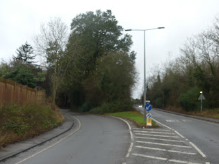
- Have a quick look at the Sawbridgeworth Brook and then keep straight on up the hill to the crossing point at Brook Road. Take great care in crossing.
- Follow the path up to the Park entrance noting the ivy-covered hedge on the left. This will be good for biodiversity at all times of the year.
- Into the Park and follow Oak Walk all the way through to its junction with Pishiobury Drive. Note the veteran Oak trees and the change in the tree species in the last third and much younger section of Walk.
- Cross over Pishiobury Drive and keep walking straight on towards Old Harlow. On the left is an overgrown Meadow which is rapidly reverting to scrub and will eventually become oak woodland. Young oaks can be seen dotted all over the field. It is a good place to look for oak apples.
- On the left at the end of this path is an old oak which reminds us that we are still on what used to be the other half of the Park. Note the red rot heartwood which is high in invertebrate biodiversity.
- Here you will find a gravelly pool which I refer to as the Pishiobury Brook. The water flowing through here has travelled all the way through the serpentine lake and will rejoin the old River Stort at the main road. There are two gravelly pools which has been created by the farmers dumping loads of gravel into the brook to make a place where cattle could safely drink. All this whole area used to be grazed by cattle.
- Bear right and head towards the industrial buildings in the distance. You will meet the canal which is still in its original river course. As you follow the path keep an eye open for birds of a range of different varieties flying over. Note also that there are some Alder trees growing along the riverbank.
- When you reach the industrial buildings you will find two spillways. Note the drop in water level which indicates to you how the River was engineered to create a volume of water to run Harlow corn mill. This volume of water upstream of the mill was called the 'stilling pond'. Take care crossing over the spillways and also take care walking along the narrow footpath by the development.
- Cross over the River by the main road bridge and turn sharp left back on yourself towards Coho restaurant. See how many different types of natural stone 'sets' that have been used in the path at this point. This area was up until relatively recently a small grassy area where rowing boats could be hired and where the Eastern Counties Otter Hounds used to meet up until the early 1960s.
- Make your way along the towing path until you come out onto the open area of Harlow Marshes. This is a designated flood area being the floodplain for the river. At times of high rainfall and flood, water is deliberately allowed out onto this area as a safety valve. Historically, when it was grazed there used to be lots of open water where people used to skate in hard winters.
- As you make your way along the towing path keep an eye out for Siskins feeding on the Alder trees on the opposite bank. If you should be here early morning or late evening it is an excellent place to see a Barn Owl hunting.
- As you come to the end of the marshes you will cross over the Pincey Brook which is one of the main tributary is of the River and has come all the way down from Takeley and Stansted Airport.
- More or less opposite this point note there is a cut in the bank where the serpentine lake used to flow back into the river. Also at this point and on your right-hand side is a small sand/gravel pit now used a lot for off-road biking it was at one time home to a local hermit.
- On your left hand side you now have a good view over the floodplain of the River and on your right you will see that you are coming increasingly close to the railway. The bank has had to be shored up here the safety. Find the dry culvert which is on the line of a ditch coming down from farmland on the other side of the railway. It would make a perfect place for a Otter to lie up in. Keep your eyes open for birds, particularly in the wintertime feeding on berries on the opposite bank. There are also several dead trees along this section where you can see Cormorants perching.
- As you walk along keep your ears open for running water as a small spring passes underneath the towing path and empties into the river.
- As you reach Feakes Lock, note the backwater rejoining the canal after it has travelled all the way around the floodplain in its natural course.
- Above the Lock you are passing through a cut which was made through one of the very old post glacial river terraces and the evidence for this is in the gravelly soil on the farmers field to the right.
- In front of you is a horse bridge which is the point at which a horse pulling a barge would have changed from one bank to the other. The fields on the left are Private and therefore undisturbed and you can often see a range of different birds feeding including Little Egret.
- On your left is what is known as the More Pool and the whole area is known locally as 'The Mores' which is an old Anglo-Saxon word for wet marshy area. The second spillway which is more of a weir has a very old water control mechanism which would have been used to control the flow of water through the serpentine lake.
- Keep on the towing path and on your left is an area of 'carbon offsetting'where land has been bought and planted up with willow trees. On the right, you may be able to spot a wet marshy area which is often very good for a range of water birds but you would need binoculars to see them. CWS 48/01
- Just before you reach the little wood on the left, turn sharp left onto the boardwalk, following it up to the dry meadow which is part of Pishiobury Park. Note the very old Hazel trees on your right hand side.
- The dry meadow, more properly known as Springhall Field is the site of the Neolithic Causewayed Enclosure of which nothing is visible at the present time.
- Turn sharp right into Springhall Lane and as you walk along count the number of different types of trees and shrubs you can see and this will give you an indication of the age of the hedge.
- At the bottom you will encounter the Sawbridgeworth Brook. Look for waterside plants growing on the banks.
- Turn right into Vantorts Road and walk up the hill, noting the old redbrick wall on the left which will be host to a range of biodiversity including plants and invertebrates.
- At the top of the hill there is the road which leads into Vantorts Open Space. Because the soil is poor here, you can see a range of what might be considered to be 'weeds' but which are an interesting selection.
- Continue walking up Vantorts Road noting the Monkey Puzzle tree on the right and the large stump of what used to be a very large and old Walnut tree and eventually you will come back to the Fair Green. Enjoy your walk!

Comments
Post a Comment