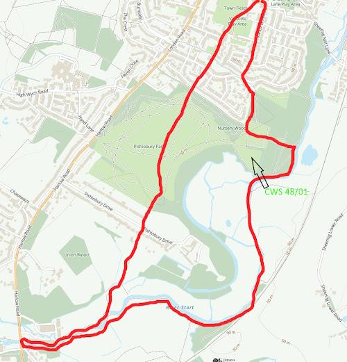
The idea of Nature Walks around Sawbridgeworth Parish is to make people aware of the wonderful wildlife resource we have locally and within walking distance. Each route is shown in a red line on an Ordnance Survey map. Theoretically, all start and finish at the Fair Green but you can of course drop in at any point. Rather then being told what to look for, I have just put pointers in along the route because I want people to look for themselves and make their own discoveries! This will mean much more to everyone! They are not intended as route marches so take your time and stop and look! All the routes follow Footpaths but inevitably, there are places where the walks have to cross roads. Do please take extreme care and follow all the safety guidelines to avoid accidents. County Wildlife sites are marked CWS and a code number.
Walk 3. 2.4 miles. Generally easy walking but can be slippery and muddy on the arable land. Recommended to avoid busy school times. Several road crossings needed, so take special care. This route will give you a good comparison between suburban/urban Sawbridgeworth and intensive agricultural land. It would be an interesting exercise to walk this route early morning in April/May to listen for birdsong and make a comparison between these two types of areas and their bird species.
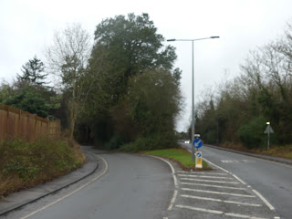
Leave the Fair Green and go into The Square. Walk down Knight Street. Note the Lime tree with Mistletoe opposite the Chinese restaurant. Note also the remaining street Horse Chestnut tree, the large Plane tree on the right and a Eucalyptus on the left .Use the pedestrian crossing at Station Road to go into Bullfields. The green triangle on the right has some interesting trees and a good show of Violets by the wall in the spring.Reedings School has a nice thick hedge for biodiversity as well as a number of trees in the grounds adjacent to the footpath and a newly formed wildlife and seating area.Opposite is the football field, which may well have its usual flock of seagulls. Note the southern age has a strip which is left to go rough and has had some tree and shrub planting. The hedge in the distance, which is along the back of the gardens in, Cambridge Road is a mature hedge which has a good mixture of trees and shrubs.As you walk through Bullfields keep an eye open for what might be called suburban birds. At the top of the hill and just before the mini roundabout, turn left and go through the gap between the houses opposite Leventhorpe School.Turn right along the Roadside footpath noting the green wooded triangle with a wide variety of different types of trees including a Medlar, which is unusual.Stop opposite the footpath sign on the other side of the road. Take extreme care crossing the road and go into the grassy field on the other side.On the left-hand side at the back of the Bull public house, you will see a line of Elm trees including some still existing pollards the type of which used to cover the land over which you are walking at a time when it was grazed by cattle. Somehow, these Elm trees have survived the disease and have suckered all their way up the hedge line.Until you reach Parsonage Farm at the top, note and identify any arable crops you see growing from now on and make a note to check on their progress as the year goes round. There is a thick hedge bordering Parsonage Farm which looks to be good for biodiversity. Find and identify the red stems of Dogwood. There is a deep ditch which could be a sort of moat, but is more likely to just be a drainage channel.Walk out across arable land where the farmer has left a narrow green strip. In the season, this green strip has a reasonable selection of what might be considered to be arable 'weeds'. At the bottom end there is a small un-cultivated triangle which is always worth inspecting for biodiversity.At this point you have to follow the line of a mixed hedge where it would be worthwhile trying to identify different species. Observe typical agricultural land hedge management. Cross the ditch to the other side and progress down the green margin towards West Road.You will note that the footpath branches, going through the wooded strip to take you back down to Cambridge Road. We are going to continue down towards West Road. Identify a range of tree species in this strip of woodland. Currently, there looks to be a lot of Muntjac activity. It is very likely that this woodland strip along with the copse on your right were planted as a screen for Sawbridgeworth.Follow the green footpath strip which follows the line of a ditch. This area used to be locally known as the 'Racecourse' probably because it was the habit of farmers who followed the foxhounds on horseback to have a couple of horses which they would enter in the local point-to-point races and in order to practice they would have a couple of jumps on their farm as a home practice circuit.At the point where the green strip finishes, you will enter a short run of old lane, which was probably an access point to the fields. Note Hazel, Spindle, Field Maple and Blackthorn. At this point we are at the headwaters of the Sawbridgeworth Brook and a significant flow comes in from the green meadow on the right which is coming down from Tharbies Farm which we shall visit on another of our walks. Exit this green lane and take great care coming out onto West Road. Cross over the road to the footpath on the south side. Walk up the hill noting first of all the steep bank on the north side with a covering of native creeping plants and shrubs. On the south side where you are walking, there are a series of brick walls which being on the north side get very little direct sunshine and have a good covering of mosses and lichens. You will also see that there is a constant population of street weeds at the base of these walls for the same reasons.At the point where Roseacres branches off, glimpse the large mature trees which used to be in the garden of a large house called Stoneleigh , which was demolished to make room for development.Continue to walk up West Road towards the main road. Unfortunately, you will note that a lot of people have paved over their gardens for parking with no provision made for storage of run-off water, similarly, a significant number of people have directed the run-off from the roofs of their houses straight onto these impervious surfaces and this all contributes to flash flooding and less storage of water in the soil and geological deposits under our feet.Cross the main road using the pedestrian crossing and immediately turn right into Station Road. This used to be called 'Walnutree Corner' and such a tree is still visible behind the buildings at this point.Using the island crossing go over to the south side of Station Road and then turn into New Street and thence into the Orchards. This gets its name because it was part of a market garden which supplied a shop in Bell Street. See if you can find a Fig tree which is still present in the garden of one of the houses and was almost certainly originally on the Nursery/Orchard.Continue through the Orchards until you come to the narrow passageway which will lead you eventually back into Rowan Walk and Knight Street. There is the remains of an old Hawthorn hedge and some interesting garden shrubs to be seen all through this route.Return to the Fair Green.


Comments
Post a Comment